



NOVATO, California — When traditional rescue technology faltered and a dwindling smartphone battery threatened to plunge a remote Northern California hillside into silence, the key to locating an 88-year-old missing hiker rested not with veteran emergency responders, but in the hands of a 17-year-old high school senior.
The dramatic rescue, which unfolded on the afternoon of November 10 at the Mount Burdell Preserve near Novato, highlights the critical role younger generations are playing in modern emergency services. Cody Davis, a volunteer with the Marin County Search and Rescue team, ultimately relied on a creative application of a common smartphone feature—FaceTime’s remote screen-control capability—to bypass failed tracking methods and pinpoint the woman’s exact GPS coordinates just as time was running out.
The incident began earlier that day when the 88-year-old woman became separated from her hiking companions while exploring the scenic, rolling landscapes of the Mount Burdell Preserve. According to Molly Williams, operations director for Marin County Search and Rescue, the woman had somehow drifted off the established trail and headed downhill. It remains unclear precisely how the separation occurred within the group, but after their own initial attempts to locate her failed, her companions recognized the gravity of the situation and contacted emergency services for assistance.
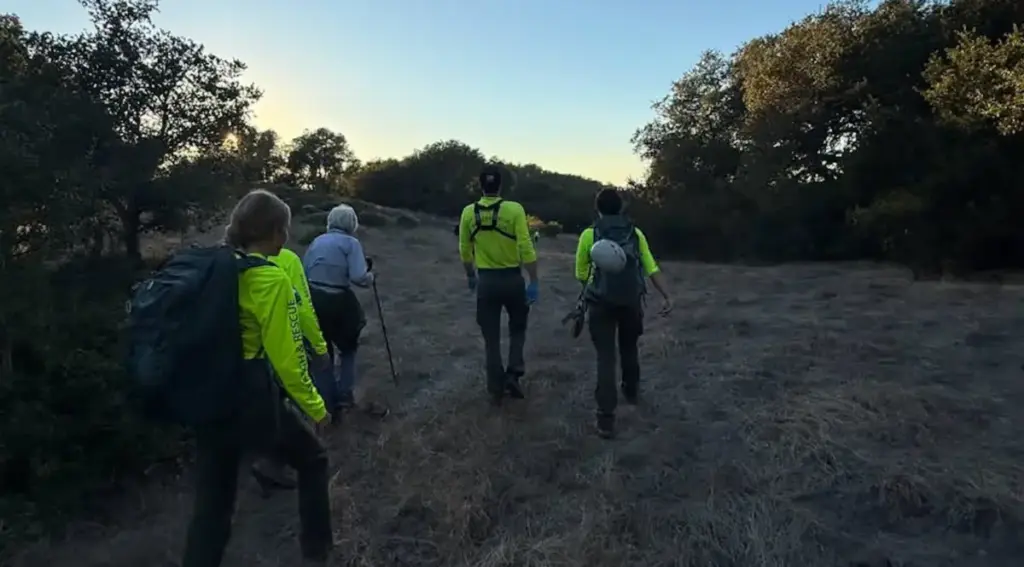
The Marin County Sheriff’s Office and its specialized search-and-rescue wing mobilized quickly, deploying approximately 50 personnel to sweep the expansive open space preserve. Williams, who oversaw the fast-moving operation, noted that the initial emergency call came in around 2:00 P.M. With daylight waning and the terrain presenting natural challenges, time was immediately of the essence.
When Rescue Tech Failed, a Teenager Took Over the Screen
A detailed report of the successful rescue mission was subsequently published on the official Facebook page of the Marin County Search and Rescue group, drawing widespread attention to the innovative tactics used on the ground. Davis, a high school senior and seasoned volunteer, was among the primary wave of search-and-rescue personnel to arrive at the command post.
While public perception of emergency response might picture an adult-dominated workforce, Williams explained that youth involvement is deeply embedded in the Marin County program, which accepts dedicated volunteers starting at age 14.
"Probably a third or more of our members are high school age, and they are full members," Williams said, emphasizing their integration into field operations. "They respond in the same ways as the adults."
Before the ground teams could effectively saturate the preserve, 911 dispatchers had already attempted to locate the missing hiker using standard cellular triangulation and emergency tracking protocols, but those conventional methods yielded no results. Upon arriving at the command post, Davis immediately attempted to contact the woman directly by phone to gather contextual information about her surroundings. However, Mount Burdell’s unique topography—characterized by rolling hills and scattered clusters of trees—offered virtually no distinguishing landmarks that the disoriented hiker could describe.
Secondary digital attempts proved equally frustrating. Rescuers tried leveraging CalTopo, a specialized mapping and geographic information platform widely utilized by search-and-rescue organizations, alongside Apple’s native Find My Friends feature. Both attempts failed to establish a reliable fix on her position.
Refusing to give up, Davis established a connection with the woman over FaceTime, hoping that a visual look at her immediate surroundings might reveal a familiar tree line, rock formation, or trail marker. When visual inspection through the camera feed still failed to provide clear context, a digital breakthrough occurred. Davis remembered hearing that newer versions of Apple’s FaceTime software included a lesser-known accessibility feature allowing a trusted user to remotely view and control another person’s iPhone screen, provided the owner granted explicit permission.
"I was able to remotely access her screen, which was weird," Davis told Outside, reflecting on the unconventional rescue tactic. "I’d never done that before, but I just sorta figured it out."
The process was far from instantaneous or simple. By the time Davis initiated the remote connection, he had already spent roughly an hour and a half on the phone with the hiker. The mountainous terrain caused their calls to drop repeatedly, creating a tense cycle of reconnecting. Furthermore, the elderly hiker was understandably unfamiliar with many of the advanced features tucked away inside her device’s operating system. Despite these hurdles, the pair maintained a patient, collaborative partnership.
"She was great, and was as helpful as she could be, being unfamiliar with the device," Davis recalled. "She was a good sport."
A Race Against a Dying Phone Battery
As late afternoon shadows began lengthening across the preserve and darkness drew closer, the stakes multiplied. The hiker’s phone battery, heavily depleted from prolonged calls and previous attempts to use device utilities, flashed warnings of imminent shutdown. Operating against a ticking clock, Davis successfully navigated the remote interface to take control of her screen, altered several background location settings, and accessed the built-in Maps and Compass applications to extract her precise latitude and longitude coordinates.
Moments later, Davis verbally transmitted the exact GPS data to the search teams deployed across the field.
Williams credited Davis’s tech-savvy persistence and cool-headed problem-solving with drastically shortening the duration of the search. While confident that ground crews would have eventually swept the entire preserve and located the woman, Williams acknowledged that the technological workaround bypassed hours of searching.
"The searchers would have found her eventually, but we found her a lot faster because Cody figured that out," she noted.
Scarcely moments after Davis relayed the coordinates, the fragile cellular connection dropped out entirely as the phone’s battery finally succumbed. However, the critical intelligence was already in the hands of the field teams. When Davis managed to re-establish a final FaceTime connection moments later, the physical search had successfully culminated in a face-to-face encounter.
"I called her back just as teams were approaching, and we all saw the moment the first team made contact with her while she was on FaceTime," Davis said. "It was ultimately a cool experience."
Rescuers escorted the woman back up the slope to the main trail system. According to Williams, she emerged from the backcountry physically uninjured, in good spirits, and ready to head home.
What Search and Rescue Wants Hikers to Know
In the wake of the successful operation, Marin County Search and Rescue leadership and youth volunteers alike offered critical safety advice for outdoor enthusiasts venturing into wilderness areas and regional preserves.
Williams strongly urged recreational hikers to remain strictly with their companions, noting that separations frequently occur when members of a party move at varying paces or let their attention wander.
If hikers do find themselves lost or separated, Davis advised staying put on established trails rather than attempting to navigate downhill in a desperate bid to locate a road or structure. Search teams systematically sweep official trails first during the initial phases of a response, he explained, and wandering off those predictable paths makes it significantly harder for emergency crews to locate subjects quickly.
Furthermore, Davis recommended that outdoor enthusiasts take proactive steps before embarking on a trip by familiarizing themselves with how to quickly retrieve GPS coordinates from their smartphone’s native mapping and compass applications, enabling them to communicate their location efficiently if an emergency arises.
Ultimately, Williams pointed out that several crucial factors worked in the hiker’s favor, turning a potentially perilous overnight ordeal into a swift afternoon rescue. She carried a functioning mobile phone with a reasonable initial charge, managed to maintain a cell signal within the preserve, and reliably answered incoming emergency calls.
"Often when we get called for a search, somebody doesn’t call until their phone is dying, or they’ve used their flashlight for so long that the phone is dying," Williams warned. Starting an outdoor excursion with a fully charged device and understanding the basics of sharing digital coordinates can fundamentally alter the outcome when a routine hike unexpectedly goes off track.